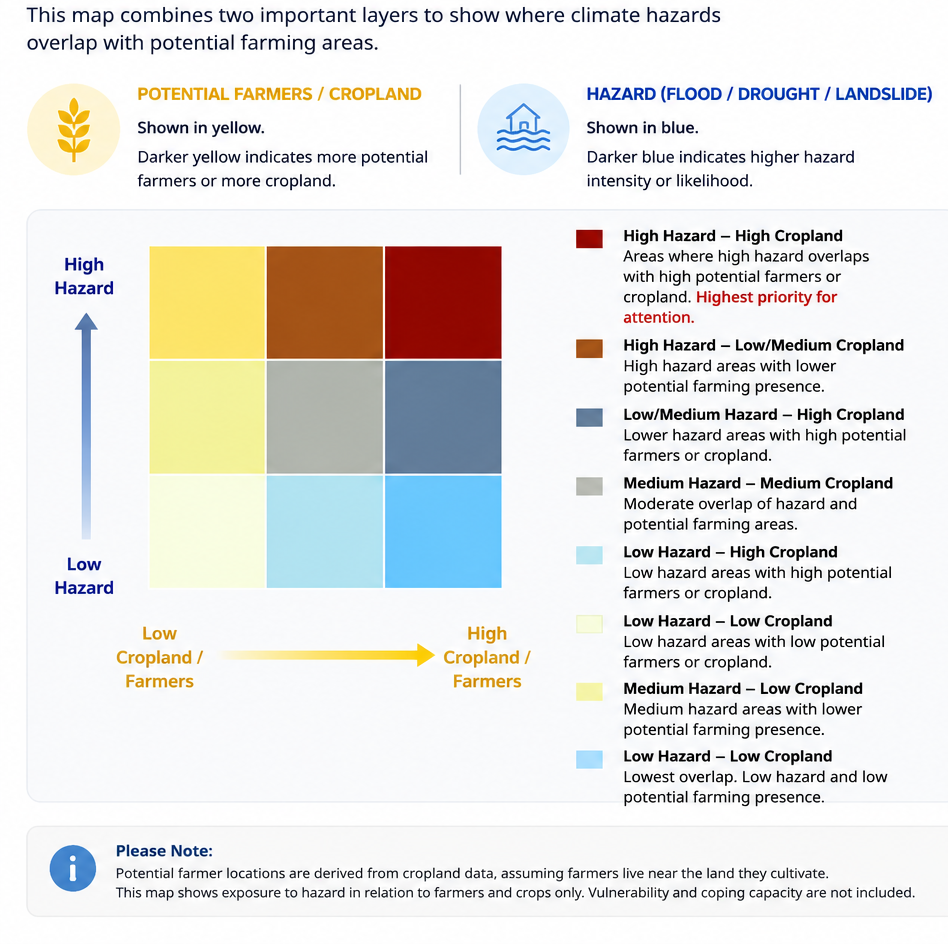




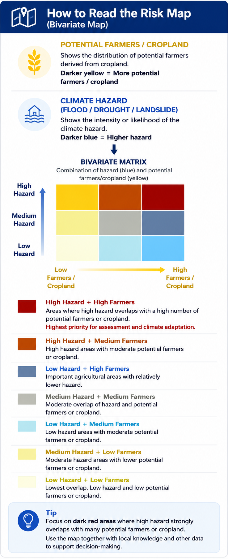
Select a starting hazard for the Macro map. You can switch hazard view after the map opens.
เลือกประเภทภัยที่ต้องการแสดงเป็นค่าเริ่มต้นบนแผนที่ โดยสามารถเปลี่ยนประเภทภัยได้ภายหลังเมื่อเข้าสู่ระบบ
This application uses a customised INFORM Risk Framework to assess climate displacement risk in Thailand. The assessment integrates Exposure to Hazards, Vulnerability, and Lack of Coping Capacity to generate a composite Climate Displacement Risk Index. The framework supports evidence-based planning by identifying communities most at risk and informing climate adaptation, disaster risk reduction, and resilient land-use planning.

ระบบนี้ใช้ กรอบการประเมินความเสี่ยง INFORM ที่ปรับให้เหมาะกับประเทศไทย โดยวิเคราะห์ 3 องค์ประกอบหลัก ได้แก่ ความเสี่ยงจากการเปลี่ยนแปลงสภาพภูมิอากาศ ความเปราะบาง และ ขีดความสามารถในการรับมือ เพื่อประเมินความเสี่ยงการย้ายถิ่นฐานจากการเปลี่ยนแปลงสภาพภูมิอากาศ และสนับสนุนการวางแผนด้านการปรับตัว การลดความเสี่ยงจากภัยพิบัติ และการใช้ประโยชน์ที่ดินอย่างยั่งยืน